Get ready

Seeing the unseen: how near-infrared imagery transforms vegetation management

Miloslav Kaláb, Climate Resilience Specialist
Miloslav Kaláb
05/03/2025
  • Ecology
  • Greenery
  • Urbanization
Trees reveal more about their health than we can see. Near-Infrared (NIR) imagery unlocks hidden insights, detecting plant stress early, measuring canopy coverage, and supporting sustainable urban planning. By leveraging NIR, we enhance urban greenery management and support the 3-30-300 rule for healthier, greener cities.
A satellite image of an urban area with trees automatically detected and outlined in red. The image illustrates an urban greenery segmentation process using near-infrared (NIR) and RGB data to classify vegetation. The segmentation highlights individual tree canopies, emphasizing the distribution of green spaces in a residential neighborhood. A text panel on the right explains the role of NIR in identifying vegetation and how spatial classification is applied to detect trees.
Article content

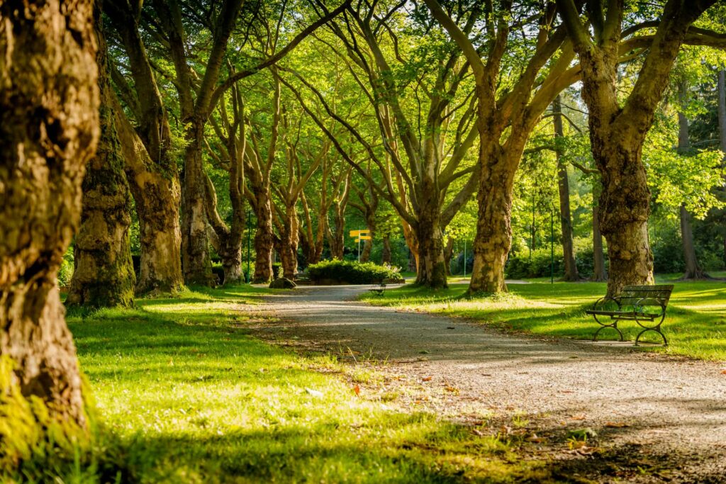
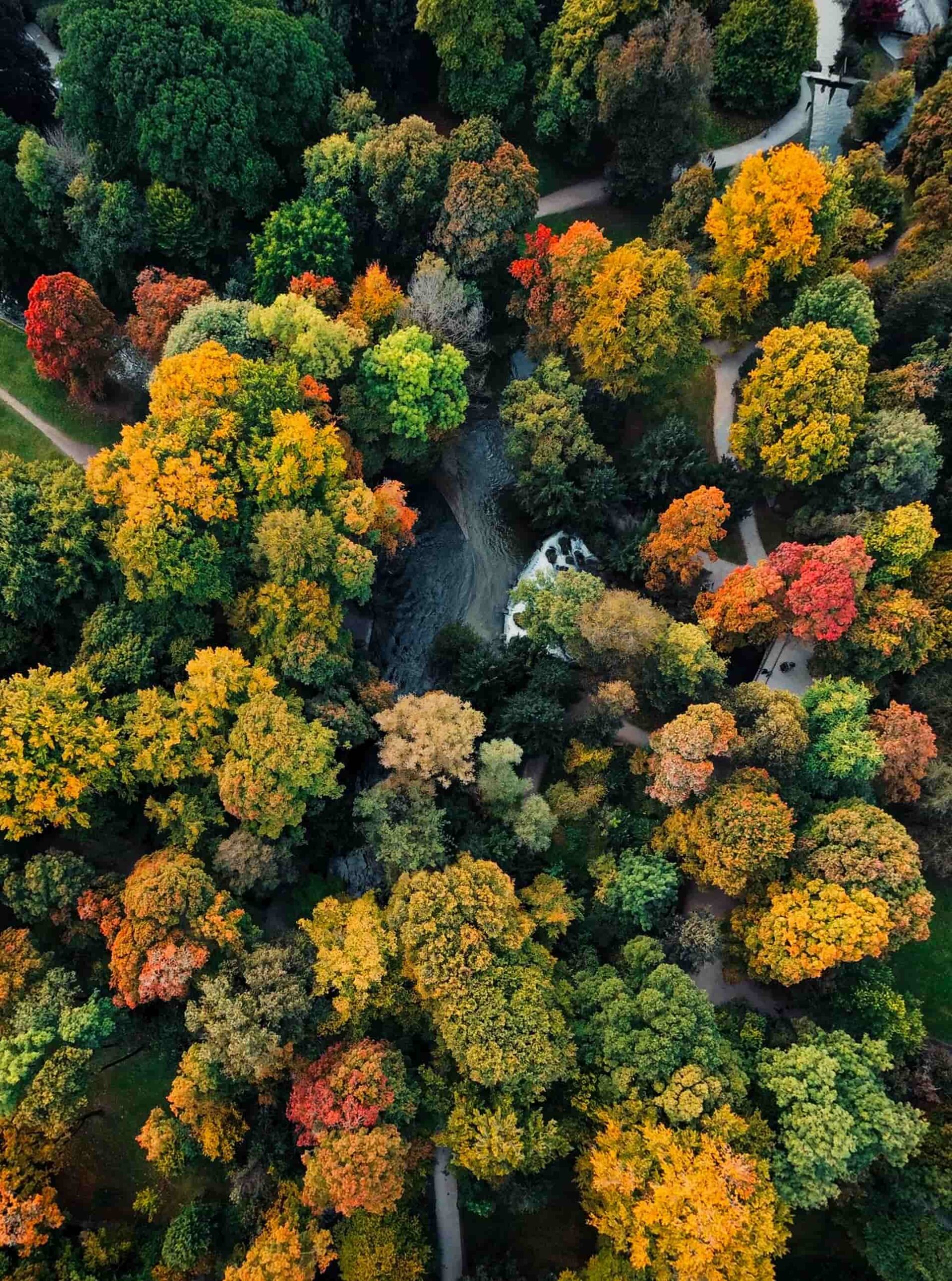
In the intricate world of plant science and urban planning, near-Infrared (NIR) imagery has emerged as a powerful tool that penetrates beyond the limitations of human vision, revealing the hidden complexities of vegetation.

The science behind NIR: A window into plant physiology

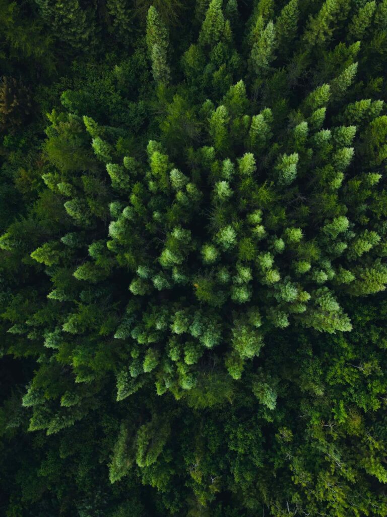
Near-Infrared imaging works within a unique range of the electromagnetic spectrum, detecting wavelengths between 700 and 1000 nanometers—just beyond the red light visible to the human eye. While we might look at a landscape and see a uniform green expanse, NIR sensors decode an entirely different narrative. Each plant emits a unique spectral signature that tells a story of health, stress, and environmental interaction.

„NIR plays a crucial role in identifying vegetation, as it is strongly reflected by healthy plant tissue due to the internal structure of leaves. Active vegetation absorbs CO₂, and during photosynthesis, visible light (especially red and blue) is absorbed by chlorophyll, while NIR is mostly reflected due to the spongy mesophyll. The amount of NIR reflected correlates with leaf structure and water content rather than direct photosynthetic activity. In contrast, dry leaves and non-living materials tend to have lower NIR reflectance, making this spectral band essential for vegetation classification.“

Miloslav Kaláb, Climate Resilience Specialist
Miloslav Kaláb
ASITIS.cz, Climate Resilience Specialist

The magic of NIR lies in its ability to penetrate multiple layers of plant tissue, revealing internal structures and physiological processes that remain invisible to traditional observation methods. Healthy plants, rich in chlorophyll and robust cell structures, reflect NIR light in distinctive patterns. This reflectance becomes a diagnostic tool, offering insights into plant vigor, water content, and potential stressors long before any visible symptoms emerge.

Early detection: The proactive approach to vegetation management

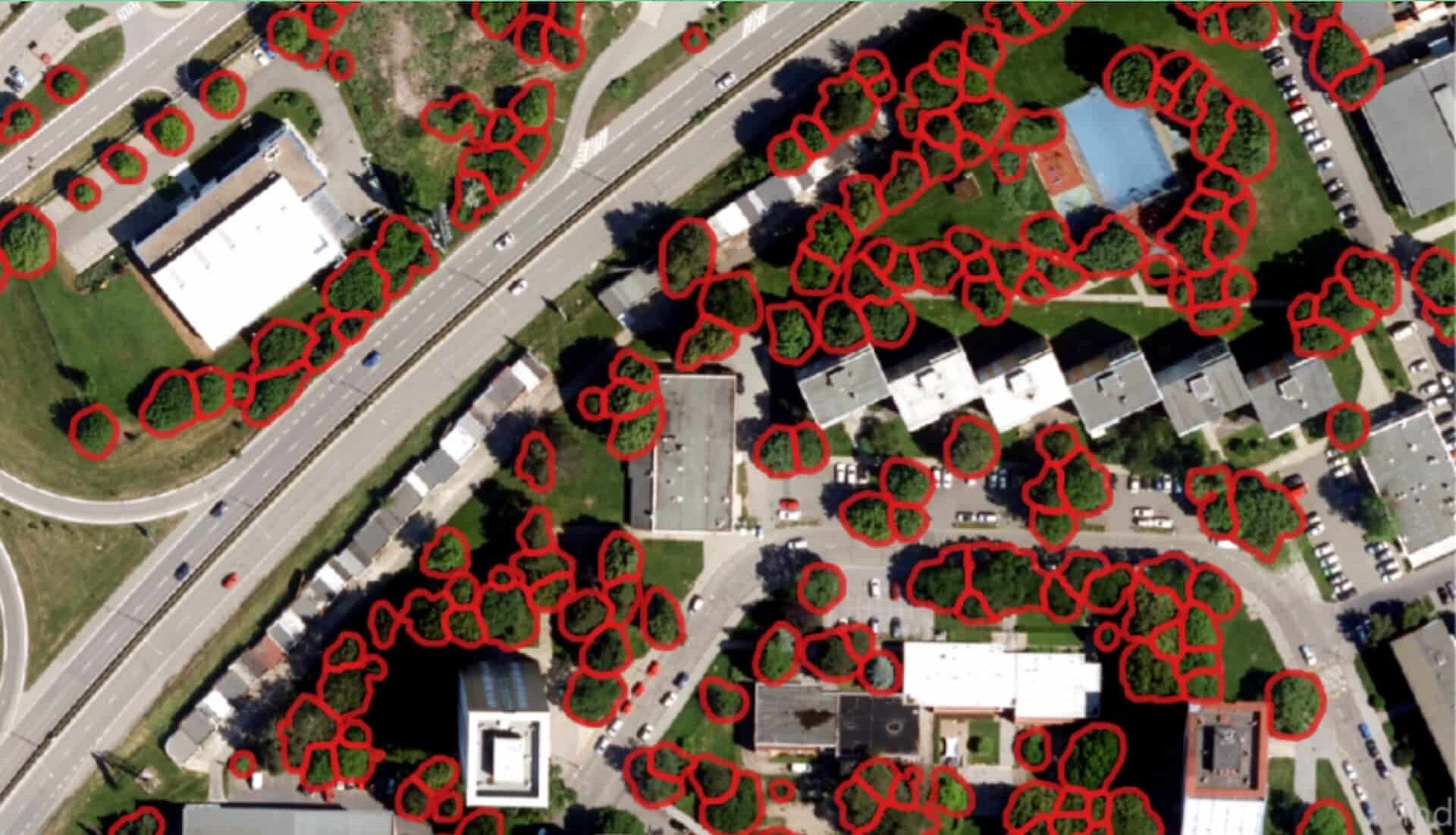
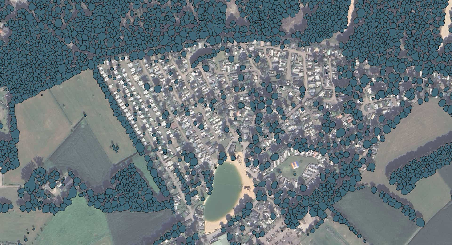
Perhaps the most remarkable capability of NIR technology is its ability to serve as an early warning system for plant health. Traditional monitoring methods often catch problems only when they’ve become severe and potentially irreversible. In contrast, NIR sensors can detect subtle changes in leaf composition that indicate emerging issues.


Imagine a farmer who can identify potential pest infestations or nutrient deficiencies weeks before they manifest visually, or an urban forester who can pinpoint tree stress in a city park before leaves begin to wither. This predictive power transforms vegetation management from a reactive to a proactive discipline, allowing for targeted interventions that can save entire crops or preserve urban green spaces.

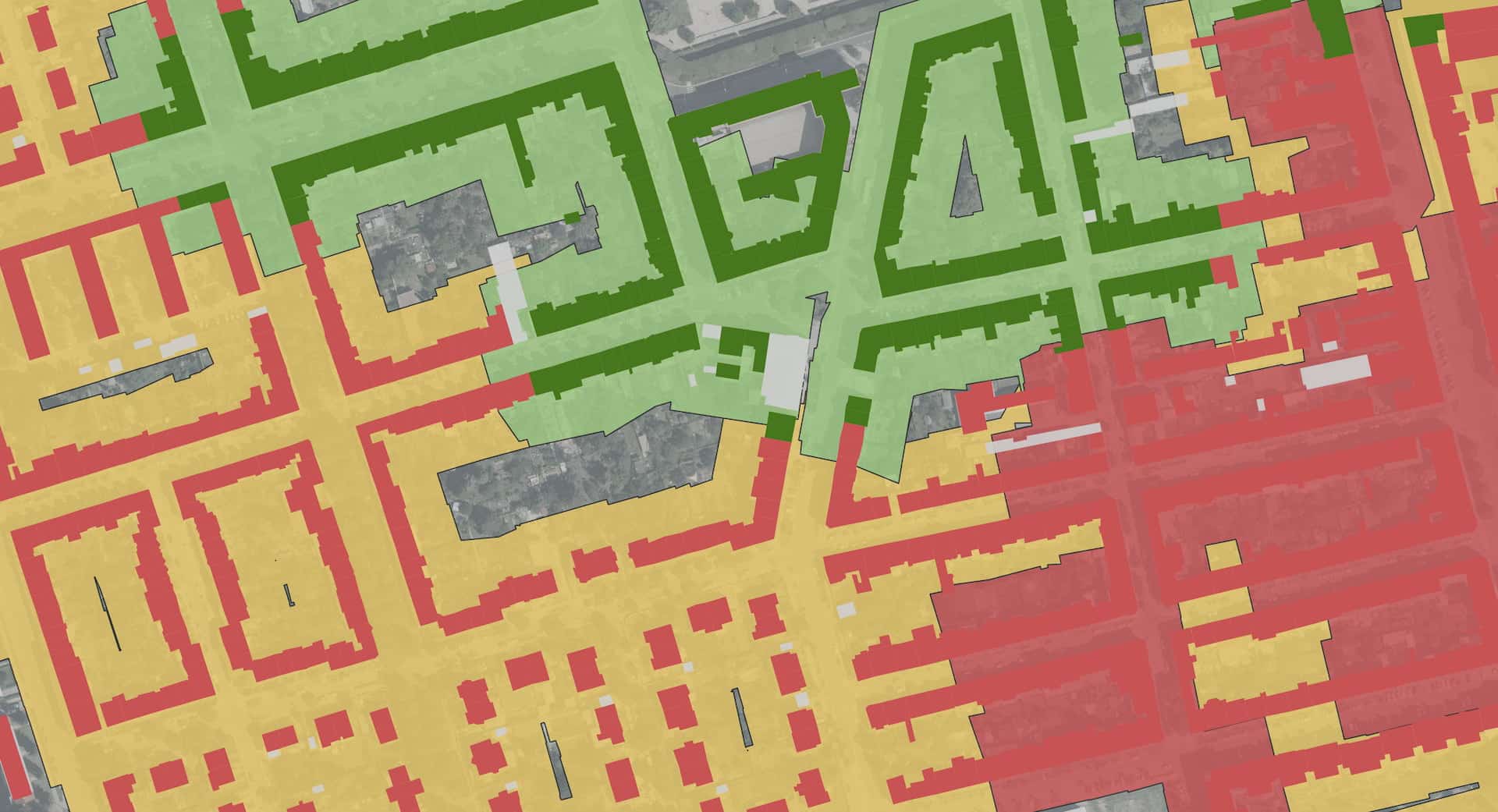
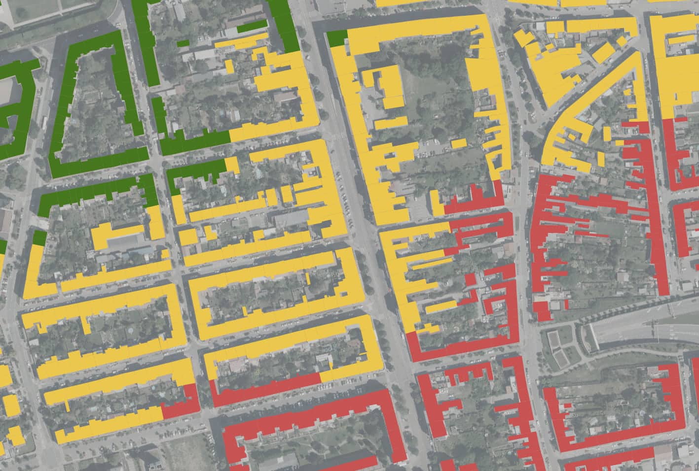
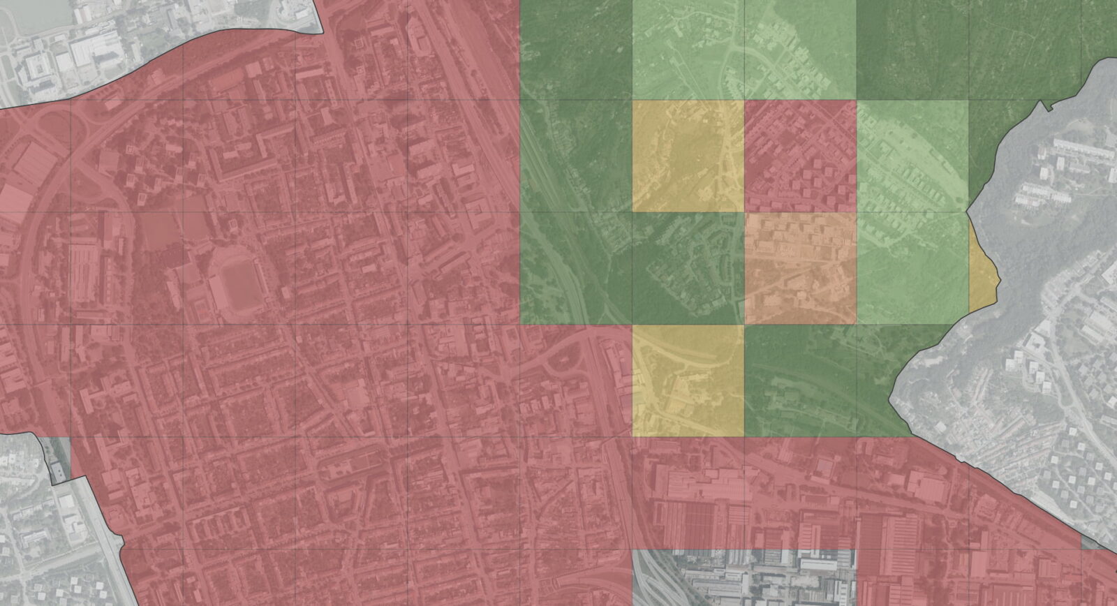
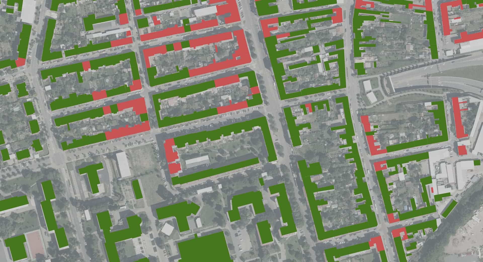
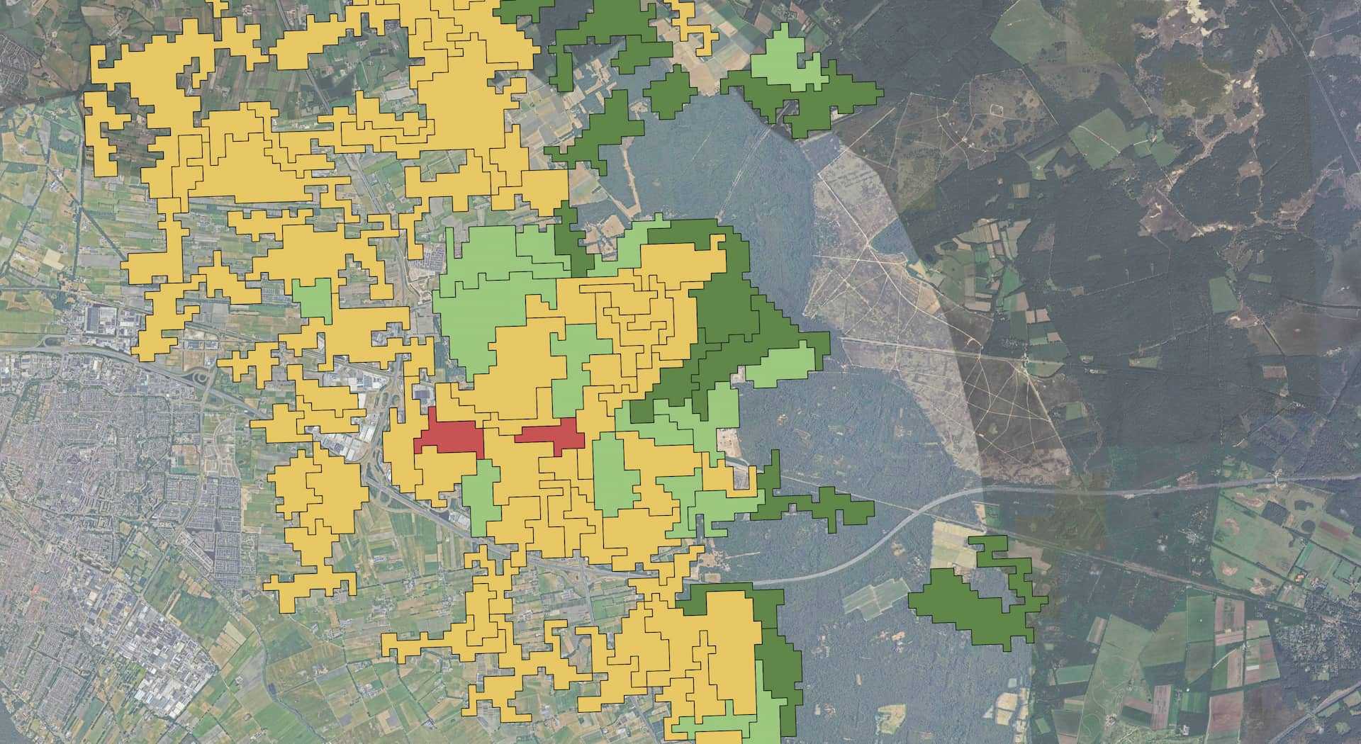
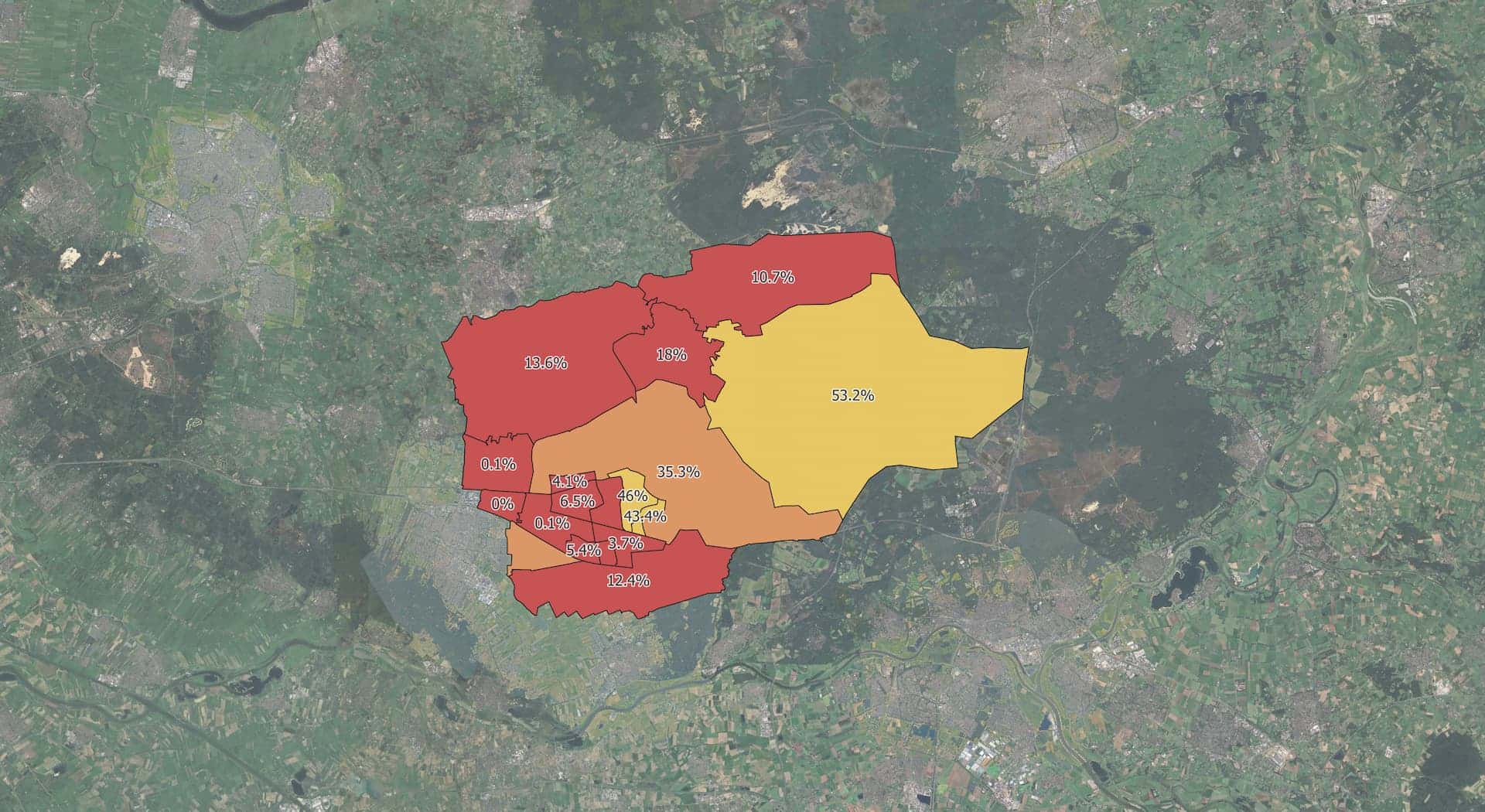
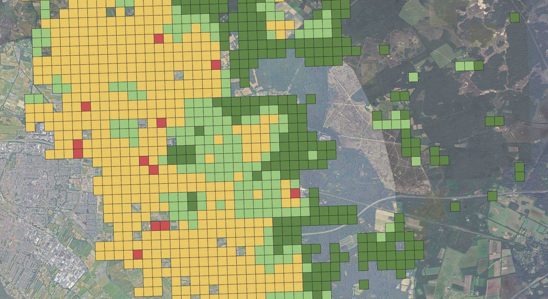
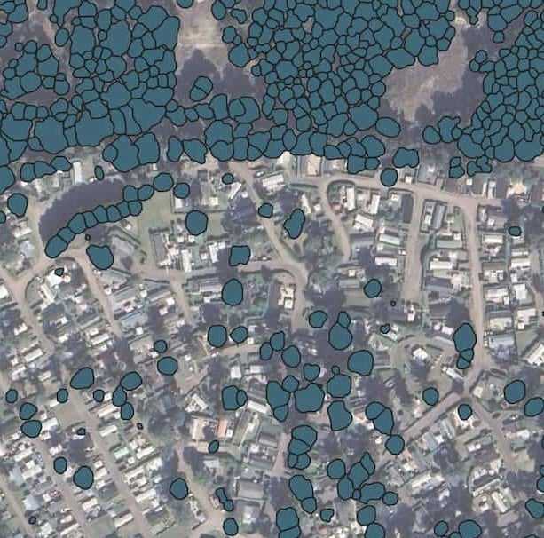
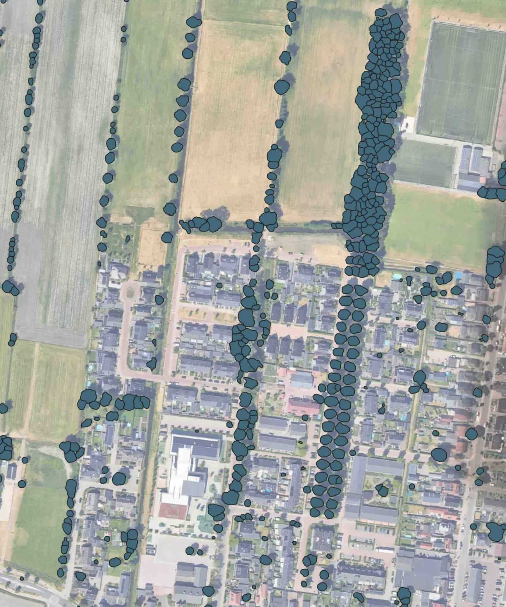
The 3+30+300 Rule: reimagining urban green spaces

Aerial image of a suburban area with automatically detected trees outlined in dark blue. The segmentation is conducted as part of the 3-30-300 assessment, which evaluates urban greenery for accessibility and environmental benefits. The image highlights the distribution of trees along streets, near buildings, and in open spaces, demonstrating how tree canopy coverage is mapped for urban planning and green infrastructure analysis.
At the heart of our mission lies the 3-30-300 urban green rule – a revolutionary concept, defined by Cecil Konijnendijk, that reimagines urban landscapes. This initiative advocates for a simple and understandable vision: every resident should be able to see three trees from their home, enjoy 30% tree canopy coverage in their neighborhood, and have access to a high-quality green space within 300 meters of their residence.

Near-Infrared technology is the key to making this vision a reality. To segment vegetation, spatial classification analysis is applied to the combined NIR and RGB data. This process automatically delineates the boundaries of individual vegetation objects, resulting in circular segments corresponding to trees. By providing this detailed mapping and precise vegetation segmentation, NIR enables city planners to make data-driven decisions about green infrastructure. 

Learn more about 3+30+300

Our 3-30-300 service helps municipalities transform urban green spaces, ensuring that every citizen has access to natural areas essential for mental and physical health. This initiative supports biodiversity and improves the local climate.


Read here.

Practical applications: from agriculture to urban planning

The versatility of NIR technology extends across multiple domains. In agriculture, farmers and tools, such as DynaCrop,  now use NIR-based devices to measure critical parameters like chlorophyll levels, sugar content, and crop moisture. These insights allow for precise resource management, optimizing irrigation, fertilization, and harvest timing.

Forestry managers have found an equally powerful ally in NIR technology. Drones equipped with NIR sensors can survey vast forest areas, detecting disease outbreaks or pest infestations in remote locations that would be challenging to access through traditional methods. This capability is crucial for early intervention and conservation efforts.

Urban planners and environmental scientists are increasingly turning to NIR as a comprehensive tool for understanding and managing green spaces. The technology provides a level of detail that goes far beyond simple visual mapping, offering insights into biodiversity, ecosystem health, and the potential impacts of climate change.
Aerial image of a suburban area with automatically detected trees outlined in dark blue. The segmentation is conducted as part of the 3-30-300 assessment, which evaluates urban greenery for accessibility and environmental benefits. The image highlights the distribution of trees along streets, near buildings, and in open spaces, demonstrating how tree canopy coverage is mapped for urban planning and green infrastructure analysis.

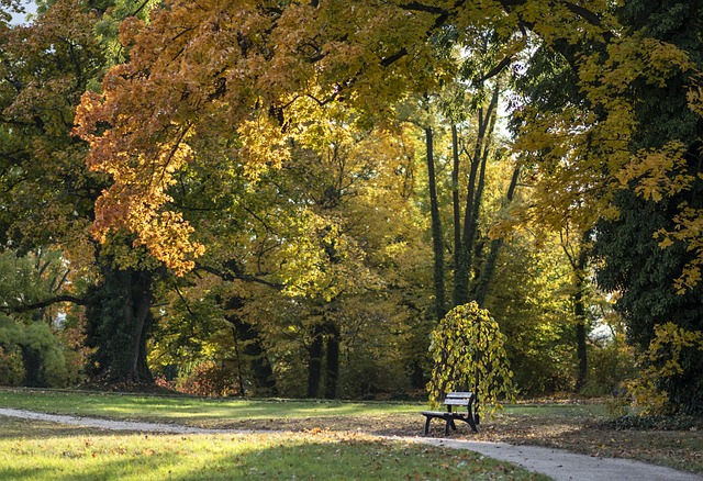
A new perspective on green spaces

Near-infrared technology represents a scientific approach to understanding the complex world of vegetation. By revealing hidden physiological processes and supporting sustainable management strategies, NIR is helping us develop a more nuanced, data-driven approach to environmental stewardship.

At ASITIS, we’re committed to accuratelly assess the 3-30-300 rule for cities and municipalities. Our goal is to create healthier, more sustainable urban environments where every resident can enjoy the profound benefits of accessible, thriving green spaces.

Read on our blog: 


As cities grow, so does the need for innovative ways to address urban challenges like air quality, extreme heat, and access to green spaces. Nature-based solutions (NbS) offer a promising approach by using natural systems—like parks, forests, and waterways—to benefit urban populations and ecosystems.

Did you like the article?

Get more articles sent to your
email and stay up to date.
Kontaktní formulář (footer)
By signing up for our newsletter you agree to our privacy policy
Miloslav Kaláb, Climate Resilience Specialist
Author of the article

Miloslav Kaláb

CEO společnosti ASITIS
Miloslav Kaláb is a well-regarded specialist in urban green infrastructure and sustainable development with over 15 years of experience. As the founder and director of Blooming Walls Ltd. and K + K Zahrada s.r.o., he has focused on innovative urban greening methods, such as vertical gardens and sustainable landscaping. Currently, he works as an Environmental & Green Infrastructure Consultant at ASITIS, where he spearheads the creation of the UpGreen tool, aimed at assisting municipalities in planning green infrastructure according to the 3-30-300 rule. Miloslav emphasizes the practical execution of strategies to boost biodiversity and climate resilience in urban areas, collaborating closely with local governments and urban planners. His work involves designing and implementing extensive projects for urban parks and public spaces that incorporate biodiversity and foster community involvement. Miloslav earned his Master’s degree in Horticulture from Mendel University in the Czech Republic and is a highly sought-after authority in sustainable urban development and management of public green spaces.
Více o autorovi

Related articles