

3-30-300
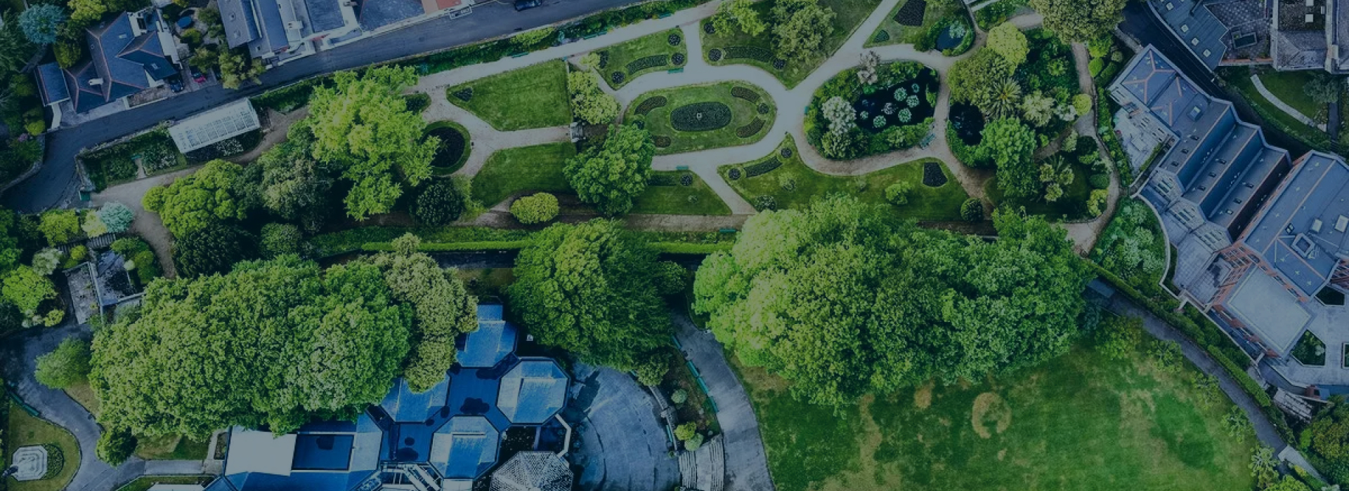
Our 3-30-300 service helps municipalities transform urban green spaces, ensuring that every citizen has access to natural areas essential for mental and physical health. This initiative supports biodiversity and improves the local climate.
I am interested in 3-30-300- We help municipalities
Implementing a more effective urban greening policy
Non-binding inquiryBeing in everyday touch with greenery brings significant benefits for mental and physical health and the work efficiency of inhabitants in every city. Local coverage of trees is positively linked with microclimate regulation (cooling effect, reduction of heat island effect). Having public greenery near the residence supports regular use of the areas with a positive effect on social, mental, and physical health. Based on the current research there is a “3-30-300 rule” providing an evaluation of greenery accessibility.


What the 3-30-300 rule can offer you
Data from satellite imagery, city data, and expert best practices allow us to bring a new service to help cities and municipalities implement more effective urban green policies.
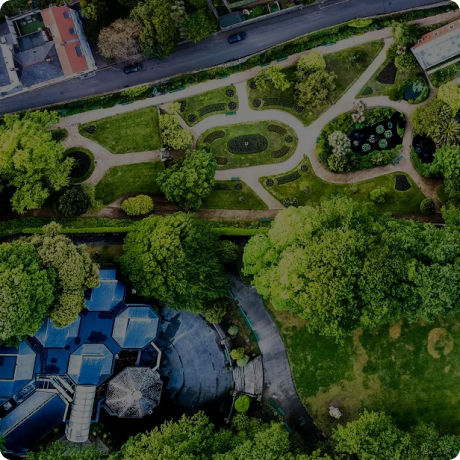
Three trees
3
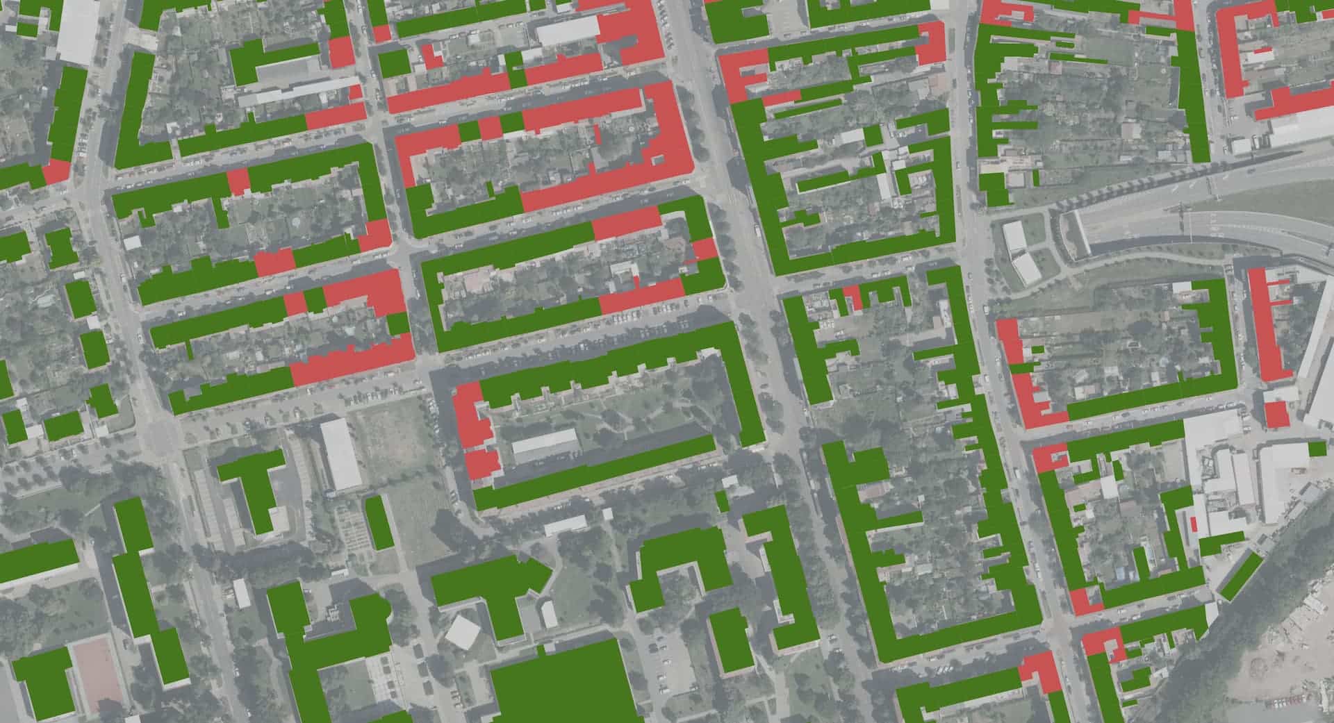
Everyone should be able to see at least three mature trees from their home, work, and school.
The presence of trees brings daily contact with nature, which has a positive impact on mental health, increases a sense of calm, and reduces stress.
The outputs include a map showing buildings with a yes/no value indicating if they meet the criteria, along with another map layer highlighting areas that either meet or don't meet the criteria based on aggregated values.
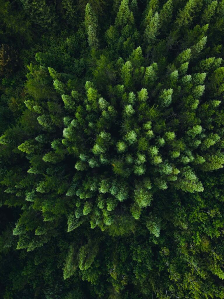
30% canopy coverage
30
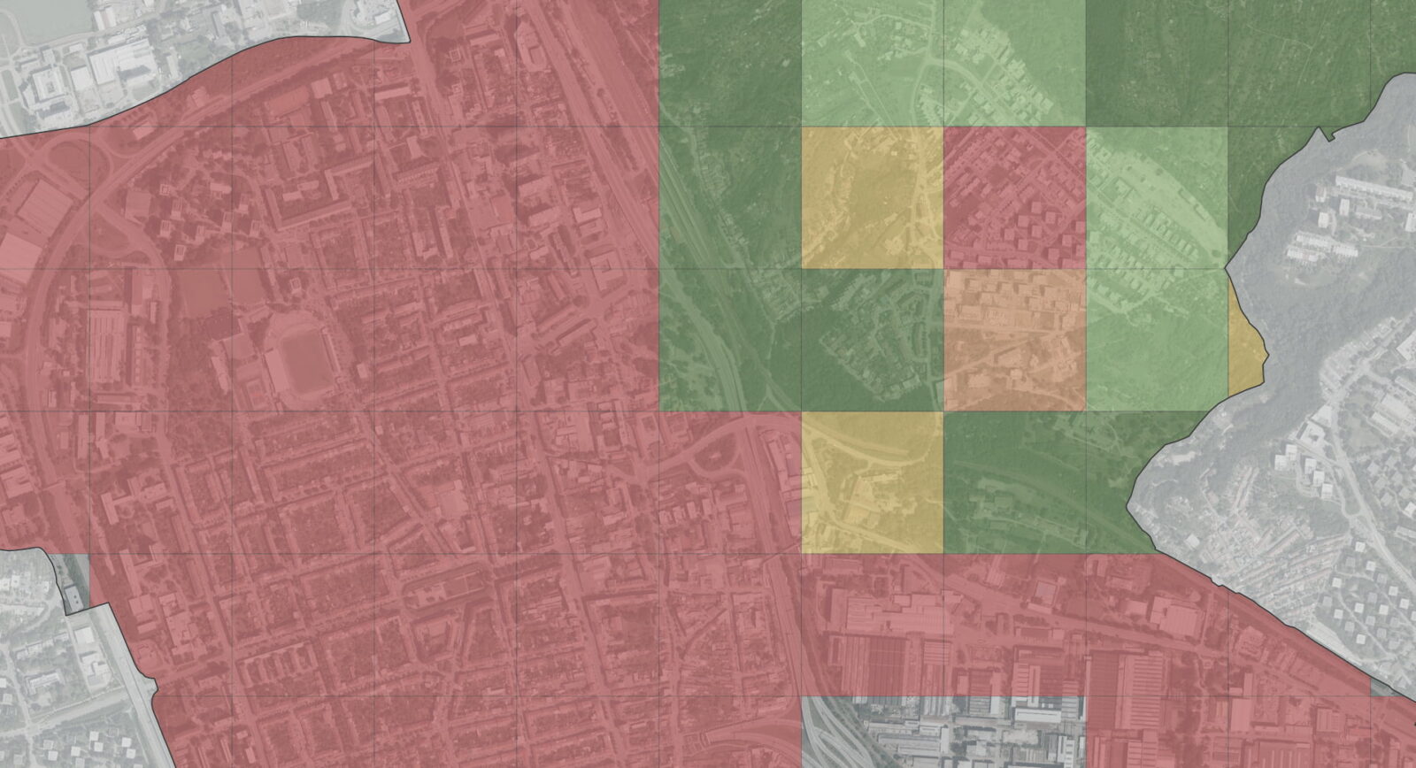
The goal is to achieve a minimum of thirty percent tree canopy coverage in every urban neighborhood.
This dense coverage helps to regulate temperature, reduce noise, and improve air quality, bringing health benefits to all residents.
The outputs include a map layer showing areas (polygons) categorized by their coverage, and another layer displaying administrative units, each assigned an average coverage value
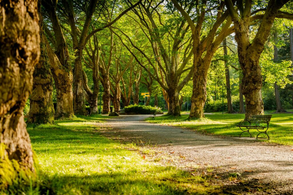
Accessibility to greenery within 300m
300
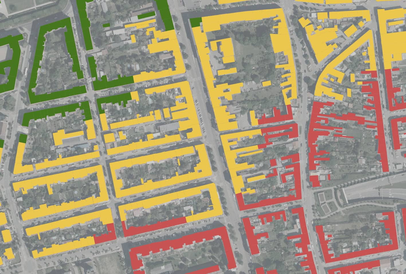
The aim is to ensure no one lives more than 300 meters from high-quality public green spaces such as parks, woodlands, or recreational areas.
This proximity to green spaces allows people easy access to natural areas, encourages physical activity, and improves social interaction between residents.
The outputs include a map layer showing buildings with a yes/no value and a map layer showing polygons categorized by their distance to the nearest park.
Overall outputs
Infographics (PDF, PNG): infographics showing problematic areas, areas of special interest, or other based on the stakeholders’ requirementsMaps: a synthesis map per-building, each assigned one of the four categories; synthesis map (clustering) layer of polygons (not) fulfilling the rule and a synthesis map per-district, each assigned percentage valueI want 3-30-300Report document: containing all results together with interpretation

The 3-30-300 service is suitable for:
Municipal politicians
Employees of municipal authorities
Urbanists
Urban greenery experts
Get back to me. I'm here for you.

Ing. Jiří Jedlička, Ph. D.
Write or call, we will be happy to answer your questions


Kdo tuto službu využil